Using AllTrails To Find Running Trails Near You
AllTrails is my go-to app for discovering new trails. Learn how I use it for finding, scouting, navigating scenic routes with the right amount of challenge.

If you're a trail runner looking to find the best local trails, scout them out beforehand, and ensure they offer the right mix of beauty, distance, safety/challenge, then AllTrails is the app you need. In this article I'm going to share how I like to use AllTrails, and what makes it a must-have tool for every trail runner.
What is AllTrails?
AllTrails is a comprehensive trail discovery and navigation app for outdoor enthusiasts including trail runners and hikers. It has an extensive database of over 450K+ curated trails, 65M+ fellow explorers, and 1.1B+
logged miles from other users. AllTrails provides detailed information, including trail maps, route reviews, photos, and difficulty levels.
With an AllTrails+ subscription (only $35.99 a year), you also get extra safety and planning features like offline maps, 3D views, and wrong-turn alerts.
Why Do I Love Using AllTrails?
Here are 5 reasons why the AllTrails app has become a favorite for me, and why I want other trail runners to know about it:
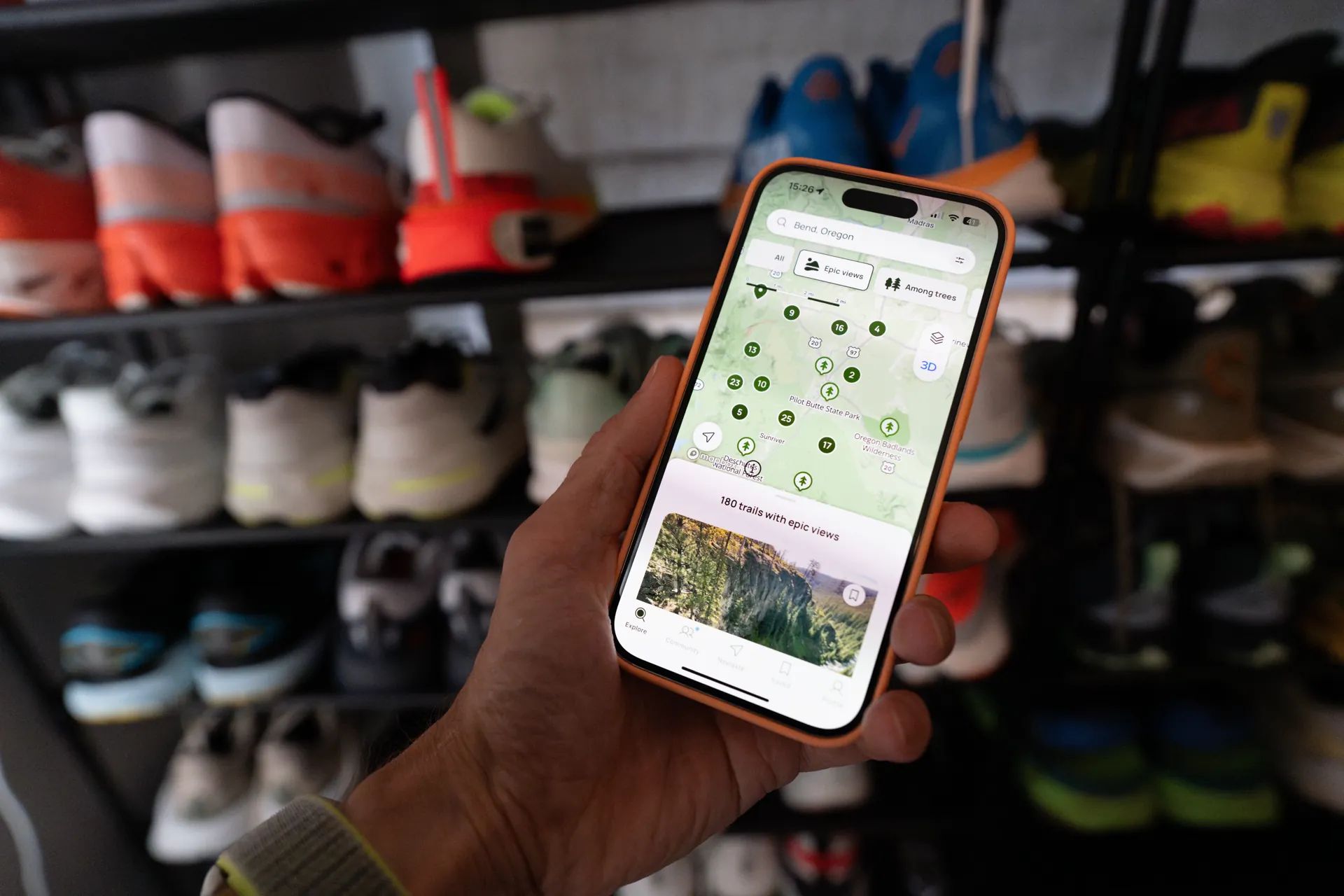
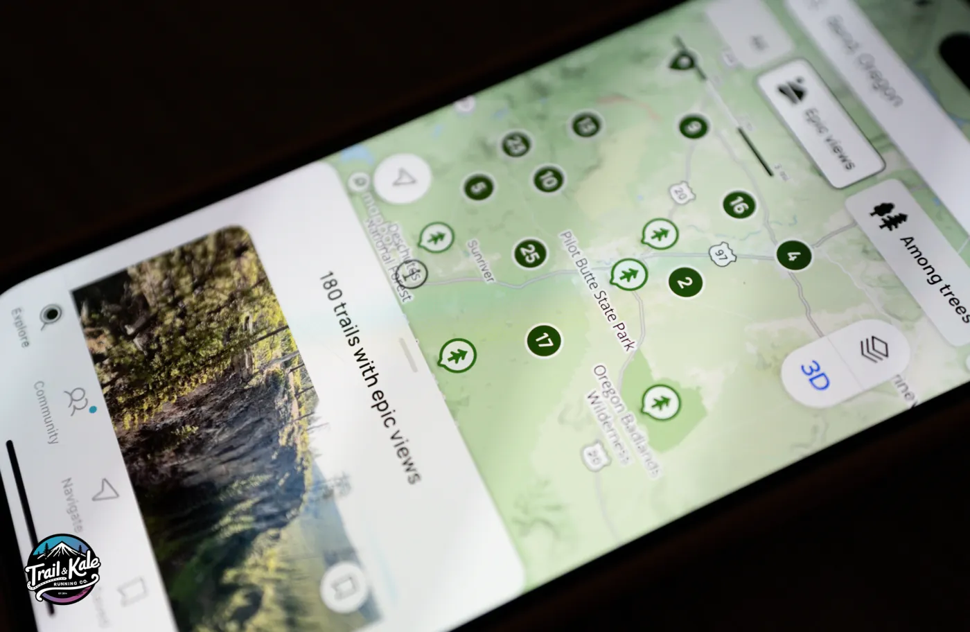
- Extensive Trail Information: With detailed trail descriptions, user reviews, and photos, you can get a feel for the trail before you even set foot on it. This helps ensure you pick the perfect trail that matches your preferences and experience level. I always start with AllTrails when I'm looking for new trails to run, and it's as simple as searching for the location you're interested in, or letting the app locate your current location.
- Interactive Maps: The app's interactive maps are very useful. You can see the trail route, elevation gain, and key points of interest. This allows you to plan your run meticulously, avoiding any unwelcome surprises along the route.
- Offline Maps: For those remote trails where cell service is spotty, AllTrails' offline maps feature is a lifesaver. Download your trail map in advance, and navigate confidently even without a signal. I also recommend getting yourself a satellite messenger if you run or hike a lot of remote trails with no cell service - it could literally be your lifeline in an emergency. Here are my favorite satellite messengers and personal locator beacons for trail running, as they're small, lightweight, and have great battery life.
- Customizable Filters: The app lets you filter trails by length, difficulty, rating, and more. Looking for a challenging 10-mile loop with stunning views? AllTrails has you covered.
- Community Engagement: The community of trail runners and hikers is vibrant and active. Reviews and photos from fellow users provide very useful insights and tips, making your trail selection process even more informed - you can also be a contributor which will give you a warm fuzzy feeling inside :OP.
How to Sign Up and How Much Does It Cost?
Getting started with AllTrails is very easy:
- Download the App: Available on both iOS and Android, download AllTrails from your app store.
- Create an Account: You can sign up using your email, Google, Facebook, or Apple account. The process is quick and hassle-free.
- Start Exploring: Once registered, you can immediately start exploring trails, creating lists of your favorites, and saving trails for offline use.
AllTrails offers a free version with basic features, but for those looking to unlock the full potential of the app, there's AllTrails Plus.
AllTrails Free vs. Plus
The free version gives you access to the trail database, reviews, photos, and basic map features which is an awesome place to get started with the app.
If you want to level up however, and get the most out of the app, AllTrails Plus costs $35.99 per year, and you get additional perks such as offline maps, wrong-turn alerts, real-time overlays (like weather and air quality), and the ability to print maps. It's a worthwhile investment for avid trail runners who want the best experience.
Thanks for reading, and let me know if you need any help with the App (either on our blog or Instagram account) - I'm always happy to help! -Alastair
Written by

Subscribe to new posts
Gear that earns its place, outdoors and at home | Reviews, Roundups, News


Member discussion